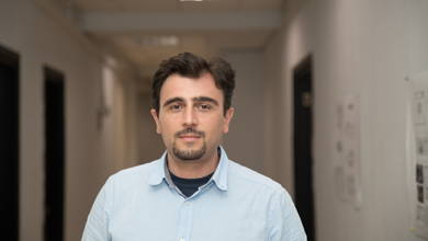
Direction:Environmental Studies and Geoinformation Systems
Position:Full Professor
Born in Tbilisi on October 18, 1976. Graduated from Komarov physics and mathematics secondary school in 1993. Enrolled the Mechanics and Mathematics Faculty of Tbilisi State University the same year, which he graduated with honor in 1997. Earned his Master degree with distinction at Informatics and Applied Mathematics in 1999.
Being a student, started working as laboratory assistant at the dept. of Regional Seismology, Institute of Geophysics from 1997. Became a head of the same department in 2004. His first international scientific experience was a visit to the University of Edinburg in 1998, funded by the British Royal Society. Since than Participated in various international workshops and conferences. Got a PhD degree in Geophysics in 2004.
2006-2010: Deputy director of Georgian Seismic Monitoring centre. In 2010 the centre was transformed into Institute of Earth Sciences. Director of the institute in 2012-2013.
2008: Assistant professor at IliaUni. Six months internship at Massachusetts Institute of Technology in 2012 played a special role in his academic development.
2013-2014: Mikheil Elashvili pursues his career as a dean of newly formed School of Engineering and meanwhile he leads the elaboration of joint project with San Diego State University, afterwards funded by the Millennium Challenge Corporation.
From 2014 Professor at IliaUni, actively pursuing scientific research and academic activities, serving as a PI of various ongoing and completed international projects. Co-founder of the Center for Cultural Heritage and Environmental Studies at IliaUni, since 2017 Director of the center. Is actively involved in mentoring master’s degree and doctoral students. Developing ongoing cooperation with the Cologne, Leipzig, Girona, Tallinn and Bridgewater (USA) universities.
For complete details see the Curriculum Vitae.
Scientific interests / research interests
Environmental Studies, Climate and Environmental Changes, Reconstruction of Paleo Environment, Geomorphology, GIS and Remote Sensing, Applied Geophysics, Geo-Archaeology.
Featured publications
1. Daniele Spizzichino, Daniela Boldini, William Frodella, Mikheil Elashvili and
Claudio Margottini, Landslide risk analysis and mitigation for the ancient rock‐cut city
of Vardzia (Georgia), Proceedings of 2017 IPL Symposium, UNESCO, Paris
2. Hannes Laermans, Mikheil Elashvili et al “Bronze Age settlement mounds on the Colchian
plain at the Black Sea coast of Georgia – a geoarchaeological perspective” , Geoarchaeology
2017, Manuscript ID GEO-16-136.R1 In Print
3. Hannes Laermanns, Daniel Kelterbaum, Simon Matthias May, Mikheil Elashvili, Stephan Opitz,
Daniela Hülle, Julian Rolkens, Jan Verheul, Svenja Riedesel, Helmut Brückner , Mid- to Late
Holocene landscape changes in the Rioni delta area (Kolkheti lowlands, W Georgia),
Quaternary International March 2017 DOI: 10.1016/j.quaint.2016.12.037
4. E. Cougill. M. Elashvili, et all, Relict basin closure and crustal shortening budgets during
continental collision: An example from Caucasus sediment provenance, Tectonics November
2016 DOI: 10.1002/2016TC004295
5. N. Jorjiashvili , M. Elashvili, M. Gigiberia, I. Shengelia, Seismic hazard analysis of Adjara region
in Georgia, Natural Hazards / Springer DOI: 10.1007/s11069-016-2167-6 ISSN 0921-030X
6. N. Chikhradze, R. Henriques, M. Elashvili, G. Kirkitadze, Z. Janelidze, N. Bolashvili, G. Lominadze,
Close Range Photogrammetry in the Survey of the Coastal Area Geoecological Conditions (on
the Example of Portugal), Earth Sciences, 2015; 4(5-1): 35-40
7. Adam M. Forte, Dawn Y. Sumner, Eric Cowgill, Marius Stoica, Ibrahim Murtuzayev, Talat Kangarli, Mikheil Elashvili, Tea Godoladze, Zurab Javakhishvili, Late Miocene to Pliocene stratigraphy of the Kura Basin, a subbasin of the South Caspian Basin: Implications for the diachroneity of stage boundaries, BASIN RESEARCH, DOI: 10.1111/bre.12069; published online: 10 MAY 2014
8. Wyss M., M. Elashvili, N.Jorjiashvili, Z. Javakhishvili, Uncertainties in Teleseismic Earthquake
Locations: Implications for Real- Time Loss Estimates, Bulletin of the Seismological Society of
America (ISSN 0037-1106), Vol. 101-3, 2012
9. Slejko D., Z. Javakhishvili, A. Rebez, M. Santulin, M. Elashvili, P.L. Bragato, T. Godoladze and J.
Garcia, 2008, Seismic hazard assessments for the Tbilisi test area (Eastern Georgia). Bollettino
di geofisica: Teorica ed Applicata. Vol. 49, n. 1, pp. 37-57.
10. Z. Javakhishvili, T. Godoladze, M. Elashvili, T. Mukhadze And I. Timchenko ” The Tbilisi
earthquake of April 25, 2002 in the context of the seismic hazard of the Tbilisi urban area”,
Bollettino Di Geofisica Teorica ed Applicata, VOL. 45, N. 3, PP. 169-185, September 2004
Books :
C.J. van Westen, M. Elashvili, et al, Atlas of Natural Hazards & Risks of Georgia, ISBN 978-9941-0-4310-9, 2012
Current Courses |
Course Catalog |
|---|---|
| Bachelor’s level
Doctoral level
Bachelor’s level
Master’s level
Doctoral level
|
2020-2021 Year Bachelor’s level
Master’s level
Doctoral level
2019-2020 Year Bachelor’s level
Master’s level
Doctoral level
2018-2019 Year Bachelor’s level
Master’s level
Doctoral level
2017-2018 Year Bachelor’s level
Master’s level
Doctoral level
2016-2017 Year Bachelor’s level
Master’s level
Doctoral level
2015-2016 Year Bachelor’s level
Master’s level
Doctoral level
2014-2015 Year Bachelor’s level
Master’s level
2013-2014 Year Bachelor’s level
Master’s level
2012-2013 Year Bachelor’s level
Master’s level
2011-2012 Year Bachelor’s level
Master’s level
Doctoral level
2010-2011 Year Bachelor’s level
Master’s level
Doctoral level
2009-2010 Year Master’s level
|

